
Blueprint to battle Bay Area sea-level rise focuses on natural solutions
By Peter Fimrite, May 2, 2019
A blueprint outlining how San Francisco Bay communities should combat sea-level rise was released early Thursday by ecosystem scientists and urban planners who envision a ring of man-made reefs, rocky beaches and graded marshlands around the largest estuary on the Pacific coast.
The carefully designed features, outlined in the 255-page San Francisco Bay Shoreline Adaptation Atlas, would in many cases replace or bury seawalls, rip rap, culverts and other crude fortifications that experts say won’t hold up as the climate warms and water rises.
The idea, developed over the past two years by the San Francisco Estuary Institute and SPUR, a San Francisco urban planning research center, is to build eco-friendly features that support wildlife and absorb, rather than repel, the rising tides.
The report comes at a critical time: The U.S. Geological Survey recently calculated that property damage from sea level rise in the Bay Area could exceed $100 billion by the end of the century if nothing is done to stop carbon dioxide emissions. The Union of Concerned Scientists said 4,100 homes in San Mateo County and nearly 4,400 in Marin County could be underwater by 2045.

The causes of climate change need to be addressed, but at the same time, scientists and planners need to brace for the fallout, experts say. Climate scientists say the sea level at the mouth of San Francisco Bay has risen almost 8 inches over the past century.
“The Bay Area is ground zero for sea-level rise,” said Warner Chabot, executive director of the Estuary Institute, who predicted the atlas would become a national model. “We have a trifecta threat of sea level rise, groundwater rising and lowland flooding from extreme weather patterns, and that guarantees a soupy shoreline future for the Bay Area.”
The plan, funded by the San Francisco Bay Regional Water Quality Control Board, is the first attempt in the Bay Area to develop a collaborative regional plan to both enhance the ecosystem and protect cities around the bay from the potential ravages of climate change.
The report was put together over the past two years in collaboration with scientists, planners and policymakers across the region. It provides graphics, explanations of ecological science and a framework for all nine Bay Area counties to build nature-like shorelines that would protect their communities.
San Francisco Bay has 400 miles of shoreline, including airports, landfills, marinas, wetlands, beaches, ports and residential neighborhoods.
The researchers divided the shoreline into 30 separate “operational landscape units” based on shoreline geology, terrain and infrastructure. They developed strategies for each section, including projects to re-route creeks into wetland areas, place shell structures offshore, use sediment to bolster shoreline elevations and create beaches to replace rip rap, the concrete or stone rubble placed along banks to prevent erosion.
The study incorporates in its recommendations restoration projects that are under way, like one at Giant Marsh in North Richmond. The California State Coastal Conservancy is installing 350 reef structures there, planting eel grass and connecting the wetlands to upland habitat. The goal is to create a sloping tidal system that starts in the water with oyster shell mounds that reduce wave action, then shifts into eel grass in the sub-tidal area and eventually marshland that slows down storm surges.


Wetlands restoration has been going on for years in the former salt ponds in the South Bay and along Highway 37 in the North Bay, buffer zones that the atlas recommends expanding. The report recommends building a Highway 37 bridge or causeway so that tidewater can better migrate into the restored wetlands.
At least 18,000 acres of potential wetlands in the Bay Area have been acquired and are slated for restoration. The goal is to eventually restore 100,000 acres of bay marsh, much of it in the Napa and Suisun areas, along the Petaluma River and in the South Bay.
Another idea in the report is to reroute Santa Clara County’s Calabazas Creek, which was diverted long ago, so that it flows into restored wetlands that need the sediment from the creek to grow. The wetlands near Calabazas are among 16,000 acres of former salt ponds in the South Bay that were cut off from the bay by earthen berms and dikes.
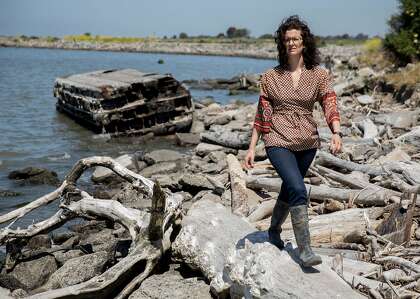
Alameda Creek, Novato Creek and many other waterways in the Bay Area should also be realigned to help build up the marshes, said Julie Beagle, deputy director of the institute’s resilient landscape program and lead author of the study.
“We can use the sediment that comes out of our hills,” Beagle said. “We have to think of our sediment as a resource.”
The authors collaborated with the California Department of Transportation, the Sonoma Land Trust and several cities in Marin and Sonoma counties to identify places along Highway 37 and near Petaluma, Napa and Sonoma creeks where new wetlands could be created.
The East Bay also is a critical area, according to the report’s authors. One example of a successful strategy, they said, is the horizontal levee built near a wastewater facility by the Oro Loma Sanitary District in Hayward. The levee uses vegetation planted on a slope that covers a vertical wall previously used to break waves. This setup allows the district to protect the facility and filter-treated wastewater through the ground instead of dumping it in the bay.
Beagle said she would like to see the beaches that once existed from Point Richmond to the Bay Bridge restored. Instead, the Highway 80 corridor is now protected mostly by rip rap, which she said speeds up erosion by essentially increasing the power of the waves that smack into the rock.
“There’s no reason in my mind that it can’t be a beach,” she said. “There is a huge amount of mudflats and shallow water, pocket beaches and small marshes. This is a place where different types of beaches would fit. You could even cover the rip rap with sand or a coarser, more porous material that would soften the wave action.”
Other strategies would have to be used for areas with less room for restoration, like Foster City, which is protected by seawalls. One solution would be to engineer shell beaches or jetties that would knock down the waves and create green infrastructure to work in coordination with the wall.
And, Beagle said, there is no way around the decrepit seawall in San Francisco, which is all that keeps the bay from reclaiming inland blocks built on landfill, including portions of the Financial District. Still, she said, it can be rebuilt as a green seawall, with pockets and textures that promote the growth of submerged aquatic vegetation, invertebrates, small mammals and fish.
The report does not address how much money would be needed — or where it would come from — to complete the projects outlined in the report. Up to $100 billion will be needed over the next 20 years just to rebuild the Bay Area’s aging shoreline infrastructure, according to recent estimates.
“We only have a few years to get a lot of these projects going because natural solutions take time to evolve,” Beagle said. “We need to get moving.”
Peter Fimrite is a San Francisco Chronicle staff writer.