Bardet & Campbell correspondence: need for southwest Benicia air monitors

By Roger Straw, October 21, 2019

Correspondence now public, “for the record” – City to provide copies at workshop on Oct. 22

Following is an email thread between Benicia activist and environmental watchdog Marilyn Bardet and City Councilmember Tom Campbell, in which they richly detail the need for air monitoring in south and west Benicia.

The exchange follows, first from Bardet, then Campbell, and finally from Bardet:

From: Marilyn Bardet
Sent: Thu, Oct 17, 2019 9:55 am
Subject: Fwd: [refineries-rule-group] We finally know what caused the refinery blast that rocked Philadelphia

Good morning, Mayor Patterson, Councilmembers, City Manager Tinfow and Fire Chief Chadwick,

The article, published yesterday (see link below) about the root cause analysis performed for understanding the Philadelphia Energy Solutions explosion and decimation should give us all pause.

The explosion of Philadelpia’s refinery is a clarion call, especially in light of the “teachable moment” of the Nustar Energy tank farm explosions and fire two days ago. Rodeo and Crockett residents are duly and rightly alarmed, as we all should be, at Phillip66’s plan for extensive expansion that would include construction of 6 new propane/butane spheres in a liquifaction zone within only ~2,300 ft of a residential neighborhood.

A point of fact:  portions of the Lower Arsenal Historic District and port area are in a recognized liquifaction zone with live pipelines crisscrossing the area, including behind Jefferson Street’s Officers Row, and 3 petroleum coke silos and pet coke terminal operations at the end of Tyler Street.

Why is this important to address now?

Our City is in the process of reviewing and considering adoption of a draft set of new design standards applicable for residential and mixed use development in the Arsenal and Downtown historic districts, and throughout the rest of town. While form-based code, established more than a decade ago, aimed to especially address the appearances of our historic districts, the code does not specifically address the overarching goal of our General Plan that calls for sustainable development. As well, the General Plan, in the Community Health and Safety chapter, also directs that new residential development should not put people in harm’s way, e.g. in close proximity to known hazards where soils may be contaminated from former uses. I would extend that concern to airborne toxic emissions, such as in the case where residential development is considered for specific locations in close proximity to pipelines, valves, stacks, and petroleum coke port terminal operations that could  impact residents’ health and safety, (whether from acute or chronic exposures to PM).

For example, refinery pipelines carrying flammable products and crude oil run behind the entire Arsenal Historic District’s “National Register C” which encompasses Jefferson Street and Jefferson Ridge. Unfortunately, residential condos were long ago permitted along Buchanan Street behind which are refinery pipelines.  The whole lower Arsenal, from Jefferson St to Grant St, to the Port area present multiple dangerous hazards, including daily truck traffic that enters and leaves the Lower Arsenal and port area often using Park Road.

I will be submitting comments and recommendations for the new form based design standards within the framework of these concerns for new residential and mixed use developments, which I have often written about, especially during the review of the Arsenal Specific Plan EIR that was not adopted.

Thank you for your time and consideration,

Marilyn


From: Tom Campbell
Sent: Sat. Oct 19, 2019, at 9:34 AM
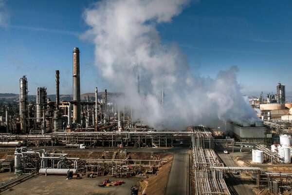
Subject: RE: Fwd: [refineries-rule-group] We finally know what caused the refinery blast that rocked Philadelphia

What the Nustar explosions and the recent Martinez flaring prove is that we need a community air monitoring system and information system to get that live time air monitoring information to the public. The south side of Benicia has no such system in place or even being contemplated. With the prevailing wind patterns and recent history it is essential in order to protect Benicians that there be air monitors in the south and southwest side of Benicia. There are none and none contemplated. Mobile monitors only give a short term transit set of information at best and are not enough for daily protection on the south and west side. This is why your approach is not going to work. Also putting the one air monitoring system near Valero is nothing put a redundant system that will only check on the fence line monitors and leaves the entire south and west side of Benicia naked. While you have chosen to concentrate on Valero you have missed all of the air pollutants coming from the refineries south of Benicia. And that is why the Good Neighbors’ choice of spending so little settlement money on air monitors was flat out wrong.

“If you can’t breath nothing else matters” American Ling Association

Tom


Marilyn Bardet <mjbardet@comcast.net>
Sent: Saturday, October 19, 2019 11:03 PM
Subject: Re: [refineries-rule-group] We finally know what caused the refinery blast that rocked Philadelphia

Hello Tom,

Unfortunately I will not be able to attend the workshop on Tuesday, and that’s why I’m writing to address your letter sent personally to me  and why I’m copying all the others to whom I’d sent my original message.  I appreciate receiving your conments and your concern to  provide a real-time, 24/7 community-based monitoring station located in the vicinity of downtown neighborhoods in the southwest area of Benicia, for all the reasons you cited: those neighborhoods are downwind of  the Phillips 66 refinery and NuStar tank farm, and depending on wind direction, the Chevron refinery.  I had written the message that your letter responds to about the  dangerous risks posed  to our community in the event of such explosions and fires as we experienced last week. I took pictures at 5pm, downtown from Maria Field and also from the Marina Green of the huge, dark sooty cloud drifting  broadly across our city and likely Vallejo from southwest to northeast.

I am certain that other GNSC members and new BCAMP board members agree—  a second monitoring station located in a southwest side neighborhood could/would be desirable to catch  those “downwind” air quality conditions. However, I disagree with your assessment of the location of the BCAMP station as “flat wrong” and that our station would somehow (impossibly) be primarily focused on refinery emissions and be thus redundantly measuring gases already captured by Valero’s fenceline openpath monitors. That just ain’t so.

The GNSC, and now the new BCAMP board, accepted that the location of the first BCAMP monitoring station was in part  determined  by the availability of a secure location with access to power—a small former cell tower cement block building now owned by Ruszel Woodworks and located on their property along Bayshore Rd. The site will sample air in the general vicinity  of the port, I-680 corridor, industrial park, Southern Pacific tracks, and the Valero southeast tank farm nearest residential neighborhoods of the upper eastside.

Our mission is to sample ambient air quality. BCAMP’s location was not chosen to selectively focus on refinery emissions, even if that were possible.

We have worked to get the Air District, meeting with Eric Stevenson, to agree to establishing a District-operated and funded monitoring station within a Benicia community neighborhood.

It is my understanding that they will be looking to assess particular opportunities with the City to identify a possible City-owned securable site for a permanent “real time” community-based monitoring system.

The GNSC is well aware, as is the BCAMP’s board, that in the future our monitors can be moved, housed in our trailer, and relocated to another secure site somewhere else in town. Perhaps BUSD could make assessments for siting a trailer on one of their school properties? The caveat:  any location identified must allow for access to the station by persons contracted to operate the systems  and perform routine maintenance and re-calibrations of equipment as necessary.

Have you got suggestions for such an optimum location for sampling ambient air quality? I see no reason why you couldn’t be involved on the part of the City in such an effort to find that additional site!

Thanks for your comments. I’m always willing to discuss!

🙂 Marilyn


Summary background: Bardet & Campbell: Benicia needs air monitors on south and west sides

Please attend the City workshop on air monitoring on Tues Oct 22, 6pm at City Hall, 250 East L Street Benicia.

Bardet & Campbell: Benicia needs air monitors on south and west sides

By Roger Straw, October 20, 2019

Fascinating email conversation between environmental watchdog Marilyn Bardet and Councilmember Tom Campbell

The Benicia Independent was copied on an important email conversation calling for better monitoring of air quality on Benicia’s south and west sides.

Longtime Benicia activist and environmental watchdog Marilyn Bardet wrote to Benicia City Council members and staff in anticipation of the October 22 City workshop on air monitoring.

Councilmember Tom Campbell replied, and Bardet responded.

It is newsworthy that both are calling for monitoring of the air that blows our way from refineries and petroleum storage farms south and west of Benicia in Contra Costa County.

There are currently no monitoring stations in south and west Benicia.

Taking off from new findings detailed in a CNBC report, “We finally know what caused the refinery blast that rocked Philadelphia” and in light of the recent massive fire at Nustar Energy tank farm, Bardet wrote about toxic hazards affecting businesses and homes near Valero Refinery.

Also responding to the Nustar fire – and recent flaring in Martinez –  Campbell wrote about the need for more monitoring of air on Benicia’s south and west sides.  Bardet agreed emphatically, calling for suggestions for the location of air monitoring stations in southwest Benicia.

The City plans to provide a written copy of their exchange at the workshop on Tuesday.  The conversation may be read here on the Benicia Independent: Bardet & Campbell correspondence.

And… please attend the City workshop on air monitoring on Tues Oct 22, 6pm at City Hall, 250 East L Street Benicia.

Benicia-Martinez bridge – a Bay Area LIFELINE in the “big one”

The Earthquake Effect: 30 years after Loma Prieta quake, scientists call Bay Area ‘Tectonic Time Bomb’

ABC 7 Eyewitness News, by Jennifer Olney, October 17, 2019

“The only big bridges built to Lifeline standards are the San Francisco-Oakland Bay Bridge and the Benicia-Martinez Bridge. The other big bridges are expected to stand up in a big quake, but might not be usable for some time after.”


SAN FRANCISCO — Thirty years after the Loma Prieta earthquake rocked the San Francisco Bay Area, killing 63 people, scientists have a chilling reminder: that quake was just a warm up.

“The first thing for people to realize is that Loma Prieta was not the big one,” warned Richard Allen, head of the U.C. Berkeley Seismological Lab.

The Loma Prieta quake in Oct. 1989 left 16,000 homes uninhabitable, knocked out a section of the Bay Bridge and caused the collapse of a double decker freeway in Oakland.

The disaster prompted an explosion of research in the Bay Area and a lot of science-based predictions about what will happen when the “real big one” hits. David Schwartz, geologist emeritus with the U.S. Geological Survey (USGS), describes the Bay Area as a “tectonic time bomb.”

ABC7 ORIGINAL SERIES: ‘The Earthquake Effect’ provides in-depth coverage on Bay Area’s readiness for the next major earthquake

“It is going to be the challenge of all our lives when we have this earthquake happen here” according to Mary Ellen Carroll, head of the San Francisco Office of Emergency Management.

The last time the San Andreas Fault unleashed its full power in the Bay Area was the Great San Francisco Quake of 1906, believed to have been magnitude 7.9.

That earthquake left an estimated 3,000 people dead and 225,000 homeless. The USGS calculates the 1906 quake released 16 times more energy than the Loma Prieta quake.

Now scientists say the network of faults running under the Bay Area is locked and loaded. The USGS calculates there is a 72 percent chance of a major quake here by the year 2043.

VIDEO: The catastrophic fall and slow rise of the Bay Bridge after Loma Prieta

“Regardless of where you live in the Bay Area, you’re not far from a fault, and there are enough faults that, if any one of them has a major earthquake, it’s going to affect the entire Bay Area,” according to USGS Geologist Belle Philibosian.

Schwartz believes many people will be surprised at the amount of damage that occurs in a major quake, despite years of improved engineering, retrofitting, rebuilding and planning.

He points to what he calls a “smaller” quake, the magnitude 6.0 temblor that hit Napa in 2014. Damage estimates ran up to a billion dollars. But in a magnitude 7.0 or a 7.9 like the one in 1906, Schwartz expects the damage to be spread over a much, much wider area.

“If you have a minute and a half or two minutes of shaking, it’s really unclear what that’s going to do to a lot of structures that are out there,” he added.

The reason California is at such high risk for earthquakes is that we are right on the edge of two huge tectonic plates in the earth’s crust — the Pacific Plate on the west and the North American Plate on the east.

RELATED: Hayward Fault – Here’s how close you are to the most dangerous fault in America

The San Andreas Fault runs between the two plates, right through California. The Pacific Plate is constantly moving north. The movement is usually so slow we don’t feel it, but sometimes the pressure builds and the ground shoots forward faster, causing an earthquake.

Scientists believe the continued movement of the plates over millions of years will eventually lead to Los Angeles being right alongside San Francisco.

Many researchers believe the Hayward Fault is actually a bigger threat to public safety than the San Andreas. Some call it the “most dangerous fault in America.”

The Hayward Fault runs just east of the San Francisco Bay, passing through 11 cities — San Jose, Fremont, Union City, Hayward, Castro Valley, San Leandro, Oakland, Berkeley, El Cerrito, Richmond and San Pablo.

VIDEO: What to pack in your earthquake emergency kit

Images from ABC7’s SKYMAP7 clearly show why the danger is so great. The Hayward Fault is underneath some of the most heavily populated areas in the Bay Area, with about 300 buildings directly on the fault itself.

“So when it moves, it moves two feet, or three feet or six feet, those structures are going to be stressed and many of them are going to fail” said Schwartz.

Some of the buildings along the fault are iconic structures including the Mormon Temple and Claremont Hotel in Oakland and the UC Berkeley Football Stadium.

Many of the major structures near the fault have had major seismic improvements, but most of the structures are homes that were built before new, tougher building standards. Experts say there is way to know how many of them will perform when a big earthquake hits the fault.

The Hayward Fault also crosses a lot of critical infrastructure including roads, utility lines and water mains.

The last time a really big earthquake hit the Hayward Fault was in 1868. Back then there were about 25,000 people in the area around the fault. Now there are about two million, most of whom probably have no idea what is happening right below them.

“Hayward Fault is pretty unique in that it creeps, so it actually is moving very, very slowly, all the time” explained Angeline Catena with the Math Science Nucleus.

VIDEO: Pet preparedness: How to keep your furry babies safe during a disaster or emergency

Over the past million years, that non-stop movement actually created the East Bay Hills, and the movement is not stopping.

Catena took us to Fremont’s original City Hall that sits right on the Hayward Fault. Back in 1972, a huge crack appeared in the floor and it has been growing ever since. Fremont’s city government was moved to a new building and the old building was never repaired, so the crack remains as an ongoing record of how the fault keeps growing, moving in three different directions.

Nearby is a muddy Tule pond that was once the epicenter for research on the Hayward Fault. Schwartz and other scientists spent years digging trenches and analyzing data from the pond. That research determined that over the past 1,700 years, there have been 12 large earthquakes on the Hayward Fault.

Research at the pond is over and now a BART extension to San Jose runs right across it, directly over the fault. BART has spent millions of dollars of voter approved bond money on seismic upgrades all over the system.

Schwartz also showed us around downtown Hayward where the fault’s signature is especially obvious, from some buildings slowly sliding apart, to others completely abandoned.

“You can cover the fault up, but in the end the fault always wins” Schwartz said.

Braces and bolts tell the story of constant effort to prepare for the next big earthquake, but it’s a neverending battle. Cracks are filled in and covered up, but they just keep coming back.

Experts say it is critical the public understand the danger that is coming. That’s why the U.S. Geological Survey and its partners developed a project they call “HayWired.” It is a science-based scenario showing what could happen if a magnitude 7.0 earthquake hits the Hayward Fault.

An animated video shows the scenario. In a quake with an epicenter underneath the city of Oakland, the rupture races 52 miles along with fault toward Fremont and Richmond, with speeds up to 7-thousand miles per hour.

In the scenario, the ground in Berkeley and Hayward shifts 3 to 5 feet, ripping through buried pipes and wires. Violent and extreme shaking lasts up to thirty seconds or longer causing extreme damage.

“The predictions in the HayWired scenario are grim: 800 dead and 18,000 injured. Of course, this is just one possible way a major earthquake may play out.

Back at the San Francisco Department of Emergency Management, executive director Mary Ellen Carroll explained that realistic scenarios of what to expect in a big quake are a serious planning tool.

“How we prepare for something that we haven’t experienced is that we pretend,” she said.

Carroll showed us around the command center where her team sometimes practices for major earthquakes, often in coordination with other similar departments in other cities and counties around the bay.

“We are looking at thousands of buildings lost, potentially hundreds of thousands of people that may be trapped in the city, depending on the time of day,” she said. “There will be many injuries and deaths. There’s just no way around that. It’s not good scenario.”

RELATED: A look at the most powerful earthquakes in California history above 7.0 magnitude

And don’t think you are safe just because you don’t live or work right on a fault.

“The shaking intensity isn’t right at the fault or just at the fault, it is over a pretty wide swath as you go away from the fault,” according to Richard Allen at the U.C. Berkeley Seismological Lab. In a big quake he says, “You are going to feel strong shaking across the entire region.”

For example, the 1989 Loma Prieta earthquake epicenter of was in the Santa Cruz Mountains, but some of the worst damage was actually 50 miles away. The effects of a bigger quake could travel even farther.

The experts say you should expect major power outages, most communication including mobile phones and the internet will be down, thousands of people may have no water for weeks, maybe months. In addition to shake damage, major fires could cause even more destruction.

“The question is what will that be like for those of us who survive,” Carroll said. “The steps that we take to prepare individually are so critical.”

As bad as a major quake will be, every expert we talked to agreed, we are safer now than we were 30 years ago.

The Bay Area region has spent an estimated $80 billion on a wide range of seismic improvements since Loma Prieta.

Disaster recovery expert Mary Comerio says it is money well spent and she cites a long list of improvements.

RELATED: Earthquake scale: How they are measured and what the magnitude and intensity scales mean

“We have required hospitals to be significantly upgraded all across the state, locally we have improvements to Hetch Hetchy, the water supply system and to BART,” she said. “We have also had retrofit ordinances for brick buildings and soft story apartments. Many of our police and fire stations, 911 call centers, city halls have been seismically upgraded.”

Caltrans has spent over $9 billion improving and strengthening the large bridges in the Bay Area, including the completely new eastern side of the San Francisco Bay Bridge which was finished in 2013.

“We’ve had tens of thousands of professionals come here over the last twenty years and help us with this,” said Caltrans Bay Area Chief of Public Information Bart Ney. “It’s the biggest thing that we’ve ever done as a state is prepare this region for the next earthquake.”

Even so, a major earthquake is likely to do serious damage to many roads and Bay Area airports, so Caltrans has built what it calls Lifeline Routes. Lifelines are specific highways engineered to withstand the region’s strongest expected earthquake.

“These are going to be the roadways that emergency services use to begin the relief for the area once this earthquake hits” according to Ney.

The only big bridges built to Lifeline standards are the San Francisco-Oakland Bay Bridge and the Benicia-Martinez Bridge. The other big bridges are expected to stand up in a big quake, but might not be usable for some time after.

One of the enduring lessons from Loma Prieta is that in a large scale disaster, many of us will be on our own for hours, maybe even days. Our preparation for disaster will make the difference, and so will regular people who step up when first responders are overwhelmed.

After Loma Prieta, those experiences led to the formation of a more organized citizen response for future disasters. Teams of volunteers are now constantly training all over the Bay Area, learning basic search and rescue and some first aid.

FROM THE ARCHIVES: ABC7’s Peabody Award winning coverage of 1989 Loma Prieta Earthquake

Looking back at ABC7 News Peabody Award winning coverage of the terrifying hours after the Loma Prieta quake, it is the courage and heart shown by both first responders and ordinary citizens that stands out.

Volunteers helped fight fires, searched for survivors in rubble, staffed shelters and took displaced neighbors into their homes. Restaurants donated meals and union workers provided free labor to help repair homes. All proving over and over that when it comes to fundamental values in a crisis ,we in the Bay Area are made of the right stuff.

There is a lot that is inspiring about what happened after the Loma Prieta earthquake, but there is still plenty of reason to be concerned about what is going to happen to each of us when a major quake hits. The best thing you can do is be ready.

Take a look at ABC7’s in-depth coverage of the Loma Prieta earthquake here.

Bay Area quake caused refineries to flare; ‘What happens if there’s a big one?’

Bay Area quake caused refineries to flare; ‘What happens if there’s a big one?’

10/15/19, 5:39 p.m.
The Marathon refinery in Martinez, shown here on Tuesday, experienced a problem due to Monday’s quake and had to flare. Photo: Paul Kuroda / Special to The Chronicle

A 4.5-magnitude earthquake centered in Pleasant Hill on Monday night caused flaring at the two refineries in Martinez, local officials said.

Flaring is a safety procedure to burn off excess gas. At the Marathon Petroleum refinery in Martinez, flaring stopped at 6:30 a.m. Tuesday, according to a company spokesman.

Portions of the Marathon refinery shut down after the quake and things restarted early Tuesday, Contra Costa County health department spokesman Will Harper said.

Flaring also occurred at the Shell refinery in Martinez, Harper said.

Shell spokesman Ray Fisher said by email that “some equipment was temporarily affected by the quake,” but operations were back to normal Tuesday morning.

The Chevron refinery in Richmond sustained “no known damage,” according to a spokeswoman. Valero spokeswoman Lillian Riojas said in an email Tuesday that there were no major disruptions at the company’s Benicia refinery, and operations are continuing.

But the problems in Martinez prompted some people to wonder what will happen when a bigger quake strikes.

“Thank God for a small one last night, but what happens if there’s a big one?” said Torm Nomprasseurt, a senior community organizer with the Asian Pacific Environmental Network who has lived on the fence line of the Chevron Richmond refinery since 1975.

When there is a siren warning the community because of a flare at the Chevron plant, he shelters in place with his family.

“But if an earthquake happened … and we can’t stay in our house, what are we going to do?” he said.

“This is one of the challenges of living in an earthquake area with the industrial belt,” Rep. Mark DeSaulnier, D-Concord, said Tuesday. He said officials have “gotten progressively better in the 25 years” with notifying communities about instances like flaring at refineries.

Amy Myers Jaffe, who served on the California Energy Commission’s Petroleum Market Advisory Committee and is now based at a think tank in New York, said refineries carry significant safety and environmental risks. In an earthquake, underground pipes can rupture and storage tanks of gasoline or other chemicals burn.

Robert Young, associate professor of chemical engineering practice at USC School of Engineering, who used to work for Exxon, said “flaring is a very important safety measure” because it combusts highly hazardous or acutely toxic materials instead of releasing them into the ground or inside the facility.

The plants are equipped with safety devices that tell operations to shut down automatically when a vibration is detected, said Ralph Borrmann, spokesman for the Bay Area Air Quality Management District.

“It’s a normal process that occurs when the safety devices get triggered,” Borrmann said.

The air quality district is conducting an investigation following the quake, part of standard protocol.

At 11:10 p.m. Monday, due to the Marathon refinery problems, Level 1 of the community warning system was issued, the company said. On a scale of 0 to 3 that meant there were no expected off-site health impacts and only the health department and other county agencies were notified, according to Harper, the Contra Costa County spokesman. In the case of more significant incidents, the county would issue an advisory to the community.

Separately on Tuesday afternoon, at least two tanks caught fire after an explosion at a tank farm at a NuStar facility in Rodeo in Contra Costa County. A 4.7-magnitude earthquake struck near Hollister (San Benito County) on Tuesday shortly after noon, but it was unclear whether the explosion was quake-related. Hollister and Rodeo are 100 miles apart.

The tank farm stores fuels and hydrocarbons, according to Randy Sawyer, Contra Costa County health officer, who said officials were trying to determine the explosion’s cause.

The Contra Costa County Sheriff’s Office released a shelter-in-place alert: “There is a hazardous materials emergency in Crockett and Rodeo at the NuStar facility. The danger will be much less indoors. Go inside, and close all windows and doors. Turn off all heaters, air conditioners, and fans,” the alert read.

“Unless you are using your fireplace, close your fireplace dampers and vents. Cover any cracks around doors or windows with tape or damp towels. Stay off the phone unless you need to report a life-threatening emergency at your location. Remain sheltered indoors until you receive further official instructions. Stay off the phones and do not call 911 unless you have a life threatening emergency.”

According to the company website, the facility has 24 tanks and holds a capacity of 3.04 million barrels.


Chronicle staff writer Anna Bauman contributed to this report.  Mallory Moench and Megan Cassidy are San Francisco Chronicle staff writers.